
MARS TYPICAL FOREST
OBFUSCATION
Report #103
May 28, 2006
 ----
----
I thought you might be interested in seeing an example of what investigators like myself have to deal with in this satellite imaging when it comes to South Polar Region forest evidence and where the prevalent name of the game is obfuscation on top of layers of even more obfuscation. Most of the time, nothing practical or revealing can be done about the obscuring tactics and I just have to move on giving image after image up as a lost cause and of course viewers are rarely aware of this endless process.
I keep going because I know from experience that eventually there will be a mistake made in the obscuring tactics in a few images that I can capitalize on. The trick of course is to not only happen up on one of these mistake prone images but then recognize it for what it is. I may be better at this than some but make no mistake about it, I have probably missed a whole lot of valuable evidence in passing over material too fast and failing to recognize the signs. But, at least once in a while, a mistake prone image is found by me where poor decisions have been made in the choice of tampering tactics used and I can do something about them allowing a little insight to creep through. That is the case here in this report with this image strip.
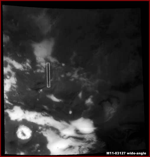
In the above left image we have the entire M11-03126 narrow-angle strip reproduced on the left but on a small scale at only 12.5% of its normal size and on the right is the companion context M11-03127 wide-angle image at its full 100% size demonstrating a wide area regional view and the location of the M11-03126 narrow-angle strip within it. This is a typical setup in the official presentation of the satellite imaging data although often there will be no companion wide-angle image made available. Now understand that both of these images are heavily obfuscated but in very different ways.
For example, even though it may at first glance not look like it, there is essentially no legitimate ground level detail visible at all in the right M11-03127 wide-angle context image. Rather it is all just direct light and dark featureless smudge image tampering applications that covers and hides all but at the same time sort of mimics ground level detail via light and dark contrasting applications. Such total obfuscation works better in the wide-angle regional images because they offer only a very distant low resolution view. So those researching the material over time and many images come to not expect much meaning that those doing the obfuscation can get away with it when the image doesn't deliver any truth. What is seen there is complete 100% illusion. No amount of clarification work by me could defeat these many layers of smudge coating/covering and bring any truth out of it that could be trusted. So, as usual and as is so typical, it's time to give it up on this particular image and move on.
Now the above narrow-angle strip on the left is a different matter. Some but not all of the tampering tactics chosen there are defeatable to a limited degree allowing a little truth to creep through. But before we get to that, note the light reflective areas both in the top and the bottom of the image and the very dark light absorbing area constituting the large middle area of the image. I'll tell you in advance that the dark middle area is super dense and very conventional forest evidence (by our Earth standards) while the light reflective area at the bottom of the strip is true light reflective terrain with plants scattered over the area and the light reflective area at the top of the strip is mostly all fake smudge image tampering covering large areas of something there. Now with that said let's get on with a closer examination of these mentioned narrow-angle strip areas in my imaging below.
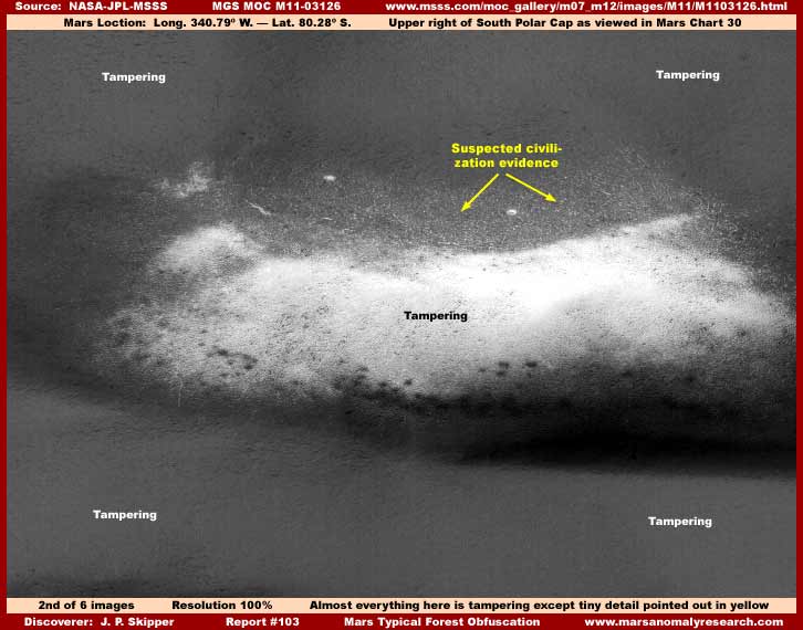
My above second image is the scene at the top of the M11-03126 narrow-angle strip. Sort of visually impressive looking isn't it? It would be even more impressive looking if it were one of the beautiful ESA colorized images. However my labels in the image speak for themselves and very little seen here is real.
The reason that the evidence pointed out by the yellow labels was left out of the tampering application is no doubt because it is too distantly seen and tiny in scale. You should be aware that a relatively small increase of just 50% in zoom factor in this poor resolution strip will produce pixelation that very quickly adversely effects any very small evidence and especially any small geometric form structure evidence. Therefore, I'm not even going to try to clarify it because I know from long experience that it can't be brought out sufficiently and will remain ambiguous in interpretation.
You should know that the use of color coordinated smudge/blur in varying degrees of density and in layers is the single most pervasive form of direct application tampering in the science data imaging when it comes to effectively hiding information. If the applications are thick and solid enough, they cannot be defeated. However, too extensive use of it has the effect you see above of creating more obviously false featureless visual vistas, so it must be used sparingly in a strip and in conjunction with many other forms of sometimes less effective tampering or else risk drawing attention to itself from even the most knot headed and obtuse scientists.
For example, a single science data strip full of this you see in my above first image would be something they would want to avoid unless the anomalous evidence in it was just too large and strong warranting the risk of discovering the tampering's existence. Likewise, multiple strips in the same general physical terrain area where a researcher might be concentrating would really be a no no where impressions and growing awareness can collectively accumulate in the researcher's head from strip to strip. Such consideration, from the secrecy point of view and fortunately for us, necessitates the use of a great variety of image tampering techniques, not all of which are fool proof.
Older technology smudge tampering, such as that used in the 1970s Viking science data, was mostly broad simple blanketing coatings of varying degrees of density depending on light and dark contrast to make them look a little believable and very obvious in retrospect to this time. However, the newer technology advancements, such as tested in the close Rover imaging and as will no doubt dominate the soon to be available MRO imaging, allows the plastering of the smudge to objects enabled by very fine small detail imaging (not officially admitted to) that can leave out some normal appearing edge detail while at the same time still thoroughly hiding the essential parts of an offending object.
Where the previous generations of tampering primarily hide evidence providing only a partially successful semblance of illusion, expect the newest MRO imaging to be much more sophisticated successfully hiding evidence and providing strong successful illusions redirecting perception away from real evidence and in directions harmless to secrecy. Very fine resolution accuracy in conjunction with software mapping technology and the speed of super computers makes all this obfuscation both possible and effective.
Historically the only tampering methodology that numerically equals or exceeds the use of direct blur/smudge applications is excessive color over saturation and the use of base image resolution manipulation. All of this is very effective and often can't be defeated but again they can't get too obvious with it either without it drawing attention to itself and it is more effective on smaller objects and less on the largest colossal size objects. So, image tampering that must ultimately span many tens of thousands of images must also come in great variety to effectively remain hidden from researcher awareness for what it really is and some of those tactics in the right mix can be dealt with allowing a little truth to come through. To a limited extent, that is the story of the evidence that follows.
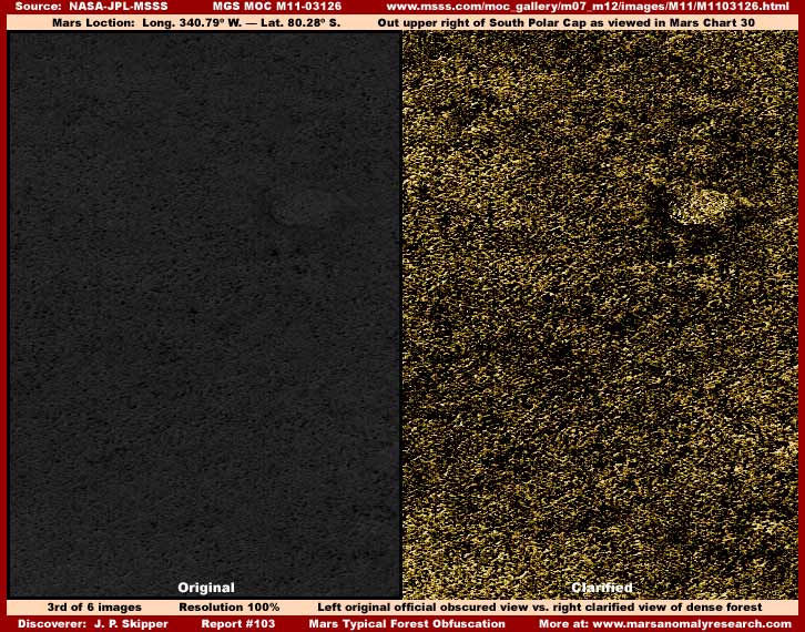
My above third split screen image on the left demonstrates a sample section of the dark light absorbing super dense forest area in the middle of the M11-03126 narrow-angle strip. This left field is exactly what you see in the official view without any clarification work in it by me. As you can see, the evidence is significantly compromised by very dark tint successfully obscuring any detail but also blur causing the evidence to tend to merge together, and poor resolution that denies us any closer zoom factor look.
Even so and even with no zoom factor at all in order to avoid the resolution problems, the dark tint and blur can be significantly even if only partially defeated leaving the split screen view on the right with the obvious and very important super dense old growth conventional (by our Earth standards) forest detail now coming through strongly. In my Report #100 titled "Mars Conventional Tree Evidence" and Report #101 titled"Mars South Polar Spouts-Plants-Forests" you have seen a lot of this type of known conventional forest evidence as seen from above visually identified and should be able to recognize this evidence without further clarifying explanations by me here.
The difference between the level of detail in the third image left and right fields is dramatic isn't it. Too bad that there isn't even a small break in this forest cover showing a little open bare light reflective terrain area because this kind of vegetation evidence is much easier to recognize at the edge demarcation line where such breaks in the vegetation cover occur providing differential contrast. Massed merging evidence in unbroken super dense coverage is always harder to be sure of what one is looking at and that much harder when subjected to manipulation that gets in behind and reinforces this perception psychology.
Even so, there simply can be no confusing the visual evidence in the right screen with any kind of natural light reflective solid particulate geology. The level of detail and its intricacy is just too great. No, what we are looking at here is fairly conventional forest canopy evidence and we are fortunate that the choice of tampering technology used to obscure this particular forest evidence was defeatable to a significant degree. The forest evidence was immediately and easily recognizable to me simply because I've looked at many tens of thousands of satellite images and have some grasp on the nature of the obfuscation processes. This contrasts sharply with scientists who will not admit to themselves must less you that it exists at all least their traditional icons all come falling down.
A independent honest trusting (naive?) scientist looking at this evidence in the original image hoping to see such living evidence but with a mindset that will not allow consideration of official level image tampering would no doubt see nothing at all but indistinct darkness and quickly move on leaving real unrecognized solid evidence in his or her wake. It is an example of what I mean when I have repeatedly stated that there can be no real understanding of what is really going on with the planetary science without taking at the very least the possibility of image tampering into consideration and using strong caution and questioning when examining this kind of obfuscated evidence.
As you can see, the real evidence is there but in order to allow it as a possibility into initial perception, one must first question what one is looking at in the official view. No questioning directly equates to moving on, no truth, and ignorance is the result!
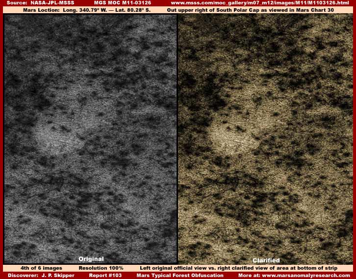
Now my above fourth image is a sample of the area at the bottom of the strip in the more light reflective area. As you can see, my clarified image in the right field doesn't add much more information over the original in the left field. That's because the type of evidence here isn't interpreted as threatening by those doing the tampering. Certainly it does look like less dense more scattered vegetation but it isn't really conclusive in that regard and could be passed off by words as merely inappropriate interpretation. On the other hand, a good view of the dense massed forest evidence in the middle area of the strip is a different matter and much harder to do away with by words and that necessitates more intense visual obfuscation. So, this fourth image evidence is apparently considered allowable and gets less obfuscation treatment.
Still, note that the more light reflective areas between the dark clumps appears to maybe be a tangle of bare limbs, roots, or branches rather than bare terrain. Now if we could have zoomed in 200%-300%, which would be normal for most strips, we could tell more about what this really is. I suspect it is the normally hidden bare bones of massed forest vegetation limb/root/branch tangles possibly in poor health or in the flux of seasonal change with their solid bare surfaces more light reflective but, oh yes, that's right, we can't get a decent look at that because the poor base resolution of this image will not allow it. Now isn't that conveniently coincidental!
On the other hand, even if the view is inhibited and what ever it is, whether terrain or bare limbs, we can at least understand that here we are looking at something real as compared to the top area of the strip represented by my second image. Note the level of detail here even if it is a bit indistinct. Now go back up to the second image light reflective area taken from the top area of the same image and compare this with the smooth featureless smudge image tampering covering broad areas. The most prevalent image tampering tool in the satellite imaging is smudge and you recognize it by the lack of detail within its fields. So there is a little something to learn here after all in comparing the fourth and second images.
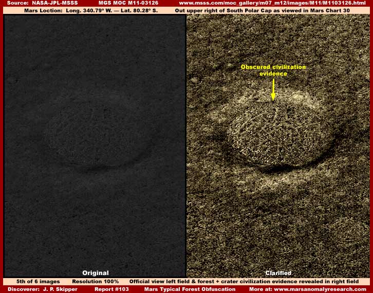
But this report isn't quite just about massive forest evidence and its obfuscation. Now take a look at my above fifth split screen image taken of another section of the strip middle dark area. Note again the densely packed forest evidence that rolls over, engulfs and visually softens the edges of this decent size crater but also look what is heavily obscured in the bottom of that crater. Even though heavily obscured and indistinct, it still looks suspiciously like organized civilization evidence patterns to me. Note the vague but still adequately seen "wheel rings and radial spokes" organizational patterns not at all consistent with the surrounding terrain vegetation random patterns outside the crater but quite consistent with civilization evidence. The next sixth image below demonstrates a poor but a bit closer view.
As you can see, the above 50% closer view of the crater bottom doesn't add much additional information. That's because the poor base resolution in the official image is already causing pixelation problems in the above sixth image that is adding to the detail density and the visual confusion in this spot. This is what usually happens with already heavily compromised at official level high density geometric structure satellite imaging evidence where the evidence is even more compromised by pixelation. Yet, some who know a little about pixelation, mostly in relation to relatively clean Earth photography without compromising manipulation, want to say that the presence of pixelation is enhancing geometric forms causing them to look more like civilization evidence.
However, even though the visual evidence surrounding the crater is super dense and so is the evidence in the bottom of the crater, their patterns are significantly different. The patterns in the crater show definite organizational qualities that many of you will not confuse with the immediately adjacent surrounding much more random forest evidence patterns seen in the prior fourth and fifth images. The civilization evidence here admittedly isn't visually strong but it is tantalizing. I pass this kind of evidence up all the time without reporting on it because I suspect that too many would find it too ambiguous as stand alone reportable type evidence.
However, here in this report the main message is the understanding and recognition of relatively conventional (by Earth standards) South Polar Region living forest evidence along with the simple power of its presence and what it implies as enumerated in previous reports and how it is so frequently obfuscated by intent and can be so easily missed by scientists not allowing for tampering factors and moving over material too quickly without questioning it. In that larger context, the above poor quality civilization evidence and its repeat of more surrounding forest evidence is just thrown in as another layer of icing on the cake so to speak.
This report will perhaps give you a little better insight into what it is like and how hard it is for independent investigators to find a little hard evidence truth in the official science data imaging that is not designed to give up any real truth very readily and is often designed to steer attention and perception in only "approved" directions supporting only "approved" perceptions of our wider planetary environments. In other words, the true science data not made available to us is truthful insight for only a select few and raw anchor dragging ignorance for the rest of us who paid for the information and who's property it really is.
It's sort of like the current oil/fuel situation. In that scenario someone is peeing down our collective collars while trying to convince us it is raining and therefore should be likened with an unavoidable natural act of nature. If you don't like it and/or when you get fed up enough with someone peeing down your collar, it's up to you to set up a collective howl threatening heads rolling before any real change will occur.
In the fuel situation, the problem is that the public's interests and that of big business and governments are not remotely the same. The technology may be out there for individuals to have a cheap power resource but it is technology not ultimately subject to long term centralized control. The mere act of revealing it and thereby its operating principles literally starts the process of control of it shifting from centralization to individuals. Can you imagine what would happen in societal evolution sparked by the impetus of a cheap individual power resource bypassing centralized big business and/or governmental control?
Current industries to survive intact in their current form and profitability must position themselves between users and any power resource maintaining centralized control and distribution of it. Likewise governments control populations via centralized direct or indirect control of essential resource distribution through control of big business and are in partnership with them in this way. So governments and big business are aligned in this way through their entity self interest that are not necessarily in the public's individual interests.
Big business and governments keep trying to find a economical source of power that they can control the distribution of and survive intact on without significantly altering the balance of power out of their favor. So they keep coming back to nuclear power because its application necessitates centralized control. Likewise, you'll see more talk of alternative fuels like ethanol because the necessary scale involved for supply to be reasonably significant again necessitates centralized control and distribution. Their problem is that both have very serious and destructive major pollution issues that fortunately begin to be better understood the more we begin to move toward them creating increased public resistance and so we always fall back in a repeating ultimately "do nothing" new cycle relying on rapidly disappearing fossil fuels. Very soon we're all going to find ourselves trapped in a very bad corner of our own making in this regard.
It's similar with the question of truth in this satellite imaging business. Many in the public want truth revealed but truth requires their fellow peers in the public to deal with complex life changing issues they fear and don't want to deal with. The latter want someone else to deal with it for them and are willing to accept official placating propaganda pabulum facilitating this illusionary psychology.
As for the secrecy crowd, despite the wider environment planetary information secretly gained during these last decades, they just don't have all the answers. From their point of view, the more they scratch the surface, the more complexity rises to that surface making control of populations in light of this information problematic. Further, what little of the government is in the know in this regard doesn't have any of the answers or even much of a clue. Yet, both know that a huge segment of the public would be demanding those very answers if they had to start openly facing true planetary issues. That makes it an issue to be avoided at the leadership level. So both overt and subtle collusion promoting secrecy and avoidance of truth prevails promoting increasing general population ignorance while individual truth seekers chaff at the delay.
Even so, no one fancying themselves as in control likes to see a general populace galvanized to action behind a historically avoided issue. When the sleeper shows any real signs of really awakening, it is then and only then that they will get off the pot and start doing something constructive and throw you and I a bone or two. If you want greater truth as to your true planetary environment beyond what you see here in this evidence record in tiny bits and pieces, you're going to have to start convincing your fellow peers that it is worth it to band together and demand it from your leadership and mean it determined that there will be serious prices for leadership if it doesn't happen. Then and only then will leadership perceive that its self interest is now better served by a semblance of truth.
Obviously, the public at large and our leaders voluntary meeting of complex issues head-on is the desired and responsible path for we Earth humans. The only other solution is to have truth imposed from without letting the chips fall where they may in our social structures and that scenario is to be avoided if at all possible. The problem is that our advancing technology level and increasing interaction with our wider planetary environment is making change inevitable as well as forcing the hand of others and we are very rapidly running out of delay and decision making maneuvering room. One way of the other, the sleeper must awaken.
DOCUMENTATION
http://www.msss.com/moc_gallery/m07_m12/images/M11/M1103126.html: This link takes you to both the official M11-03126 narrow-angle and M11-03127 wide-angle science data image strips from which all the images in this report were sourced.
, Investigator
![]()