
MARS LIFE HIDES IN PLAIN SIGHT
Report #173
November 19, 2009
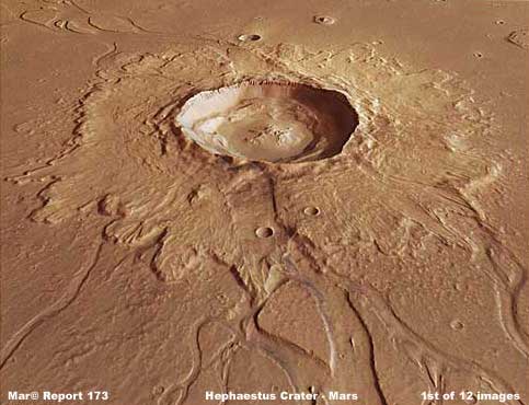
http://www.esa.int/SPECIALS/Mars_Express/SEMSKCVTGVF_1.html
http://www.satnews.com/cgi-bin/story.cgi?number=705199150
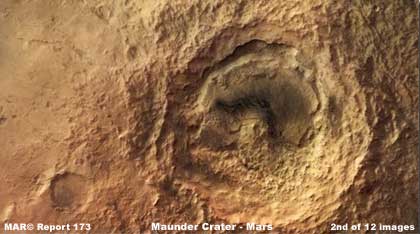
http://www.esa.int/SPECIALS/Mars_Express/SEMOHJAMS7F_1.html
The above first two images provide
sample views of Mars impact craters and their surrounding terrain. Note that
both are decent representations as to what a variety of rough raw rock and
soil geology looks like in the terrain around and in these craters that does
not appear to be compromised or modified by any extensive surface biological
life like vegetation or surface water considerations. Especially in the above
2nd image and on the right, note the many rocks and how the light and shadow
plays off of them creating the rough raw geological textures. This is the
typical look of visual impact crater geology.
This is in fact what true crater topography looks like when there is no need
to compromise the look by image tampering applications. It is rough and raw
because a rude violent event took place in this place opening up and exposing
the lower geological regions and tossing geological material into the surrounding
landscape. However, years ago when I first started this work dealing with
old 1970's Viking data, one of the very first things that I noticed was that
Mars crater outer slopes and inner areas seemed way too frequently to be the
recipient of crude featureless smudge applications that blotted out the natural
raw rock and soil geological light and shadow features in favor of smooth
blank surfaces.
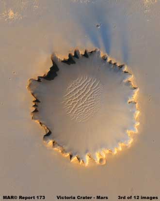
http://photojournal.jpl.nasa.gov/catalog/PIA08813
Now we come all the way forward
in time to the above 2006 MRO HiRISE image of Victoria Crater on Mars. It
is certainly pretty isn't it. My how far smooth featureless opaque smudge
applications have come. However, the result is still the same and that's in
the elimination of detail leaving only the crater rim edges sticking out of
a sea of opaque smudge applications that extend well out in the surrounding
terrain. This visually beautiful image was met with much enthusiasm by world
communities including science and academics just because presumably of it's
looks even though the great bulk of detail and information has been effectively
removed from it. You do believe that sand storms covering everything resulted
in this look don't you?
Crater sites get special treatment because, when present, they are often the
largest most obvious forms in a scene. From the secrecy point of view, that
means they can attract the eye and thereby closer examination. You never can
tell what might be hidden and/or revealed in closer views of such rough raw
terrain full of detail that might not be acceptable to a secrecy agenda. It
is easy to miss finding and obfuscating information in such a setting, so
they often get the special "treatment" inside and out, sometimes
whether they need it or not.
The AI super computers doing the work must make decisions that are often not
easy to make. For example, a smoother texture canopy forest where the life
tends to entwine with each other in a tangle and/or mat can be dealt with
by just cutting the image resolution a little and routinely backing the view
up to a greater distance. This tends to force the visuals into a smoother
unbroken merged surface that then looks like inanimate terrain rather than
life. If the forest is very healthy and massive with no broken gaps, this
is even better.
With that concept in mind, take a look at the following very subtle images
that are the reason for this reporting. This strip and the pit in the 7th
and 8th images was brought to my attention by a viewer named Lottie and thanks
to her for this evidence. Now these images are borderline visuals as to the
perception of life. Let's see what you can see in them.
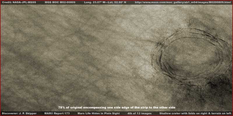
http://www.msss.com/moc_gallery/ab1_m04/images/M0200809.html
The above 4th context image demonstrates
a shallow crater with folds on its rim and interior slopes as well as a view
of the terrain a fair distance out from the crater. In fact, the view is from
one outside edge of the strip to the other encompassing everything in between.
In addition to the obvious many subtle dark streaks, note the merged soft
smoothness of the terrain. Note as well how soft and rolled looking the folds
are in the crater perimeter areas. Note the uniformity of color other than
the false color I've added and the streaks. Note the lack of any of the many
small light and shadow points as seen in the 2nd image of Maunder Crater.
It looks subtly different because it is different. In my opinion, what you
are looking at is a dense unbroken forest of growth carpeting the whole scene
including crossing over and covering all of the crater surfaces. This is an
example of bio-life evidence that is made visually borderline by resolution
manipulation and fairly effectively hidden right in plain sight
The only reason that we can see that this is a crater at all is because of
the depression surrounded by the very large deep creases of the crater rim
folds. They are too deep to disappear completely under this massive field
of growth. The truth is that we are not actually seeing any geological rock
and soil terrain at all here, just the grossly large crater folds printing
through the carpeting growth like wall imperfections printing through a fresh
coat of paint.
However, even when pointed out, it is still easy to miss diagnose this scene
and assume just a geological terrain. This is what I mean when I say such
evidence is Mars Life Hides in Plain Sight. The next two images offer closer
views that may help some in spite of the compromised resolution.
http://www.msss.com/moc_gallery/ab1_m04/images/M0200809.html
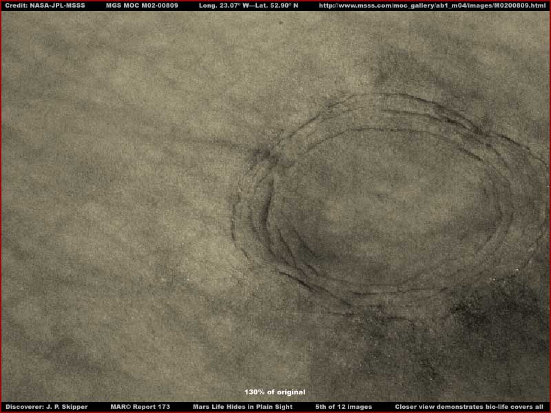
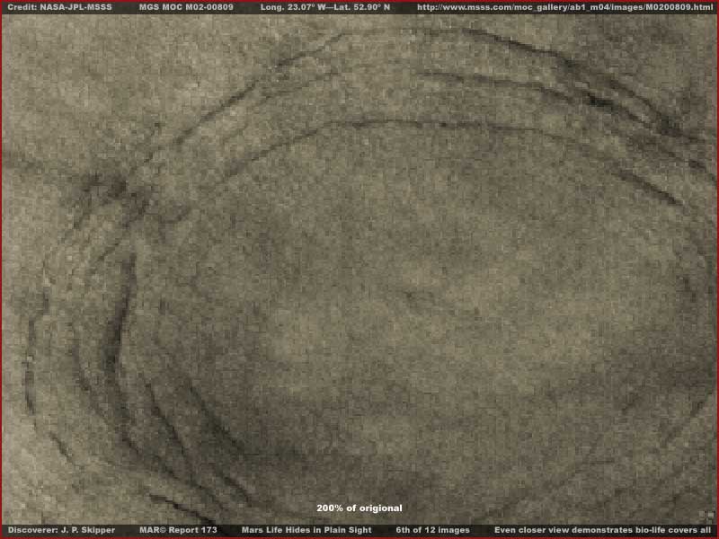
The above 5th and 6th larger images
demonstrate progressively closer views of the crater with the folds on its
rim and interior slope areas. The 6th image at 200% zoom factor is too close
and the already poor resolution is resulting in too much pixelation in the
image.
Even so I suspect you can still see the uniformity of color and how soft and
rounded appearing the folds are because of the extensive carpeting growth
covering them. You can also clearly see the absence of any of the many light
and shadow points that should be there if we were looking at raw rock and
soil geology of a blasted out impact crater as in the 2nd Maunder Crater image.
http://www.msss.com/moc_gallery/ab1_m04/images/M0200809.html
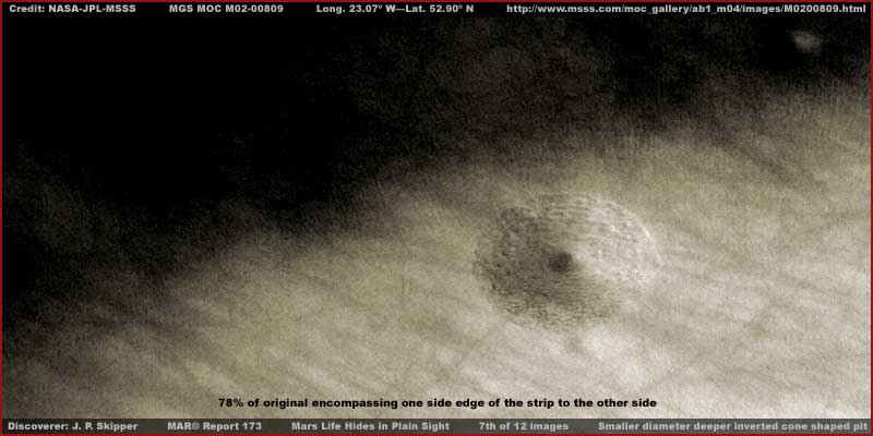
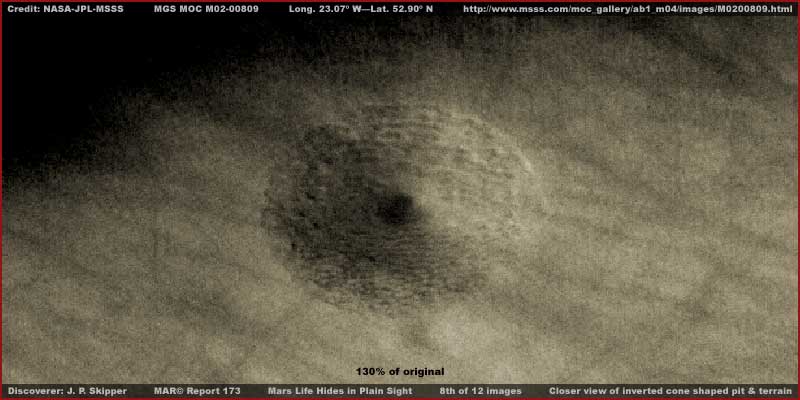
The above 7th, 8th and 9th images
are of large pit a little further down in the same strip with a couple of
progressively closer views of the pit. I did not provide a 200% zoom view
because this site is smaller and the evidence is more negatively impacted
by the increased zoom.
Note the unusual inverted tapered cone shape to the bottom of the pit. If
this is an impact crater, then this must have been very soft spongy material
or perhaps an area covered by shallow water when the impact occurred. On the
other hand, perhaps it is a collapsed sink hole as that would likely better
explain the very tapered shape of the hole.
However, we're not going to be able to answer such questions with any real
confidence from these visuals. Why? Because this terrain and this hole have
been engulfed by some kind of finer texture carpeting growth and we cannot
see any real rock and soil geology in or around the hole at all. If we could
see any rock and soil geology, we might just be able to see where the geological
material that previously occupied this hole area went. Did it fly out at impact
creating an ejecta field around the hole on the surface terrain or does its
absence tell us that it collapsed down into a cavity below this hole or some
combination thereof?
The point is that something densely carpeting this terrain is forming a visual
barrier blocking our view of the real rock and soil geology here. The logical
extrapolation is that what is blocking our view is growth of some kind aggressive
enough to fill every tiny bit of sunlight space including over the rim of
this hole and all down inside it.
Also, if you will look closely at the two different holes in the ground in
this strip, you will see that the holes look just a little oblong suggesting
that they are stretched and you would be right. Some might even wish to say
that it is because I flipped this strip resulting in some distortion. I did
flip the strip but this is not the cause of the slight distortion. You need
to understand that this is a M02-00809 strip coming from the earlier data
of the MGS MOC mission. In that earlier data, the straight strips that most
researchers use simply because they are straight and easier to scroll down
were flipped somewhere at official level. This is one of those.
As I have reported before, this flipping at official level in my opinion was
a just a small part of the many multifaceted obfuscation tactics before the
images were released to the public. Fortunately, in this particular case,
there is an available wide-angle context M02-00810 image as appears below
available to enable proof of this flipping at official level.
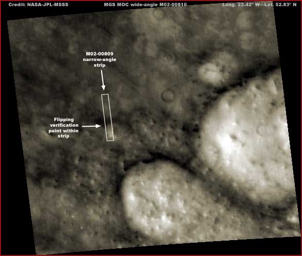
http://www.msss.com/moc_gallery/ab1_m04/images/M0200809.html
If you will go to the official MSSS
site at the links above, you will see the M02-00809
narrow-angle image on the left and the wide-angle M02-00810
image on the right with the M02-00809 strip outline within it. There the first
two strip links on the left demonstrate sinusoidal (angled) .jpeg and .gif
strips. If you open them up, you will see that their orientation agrees with
the strip outline within the wide-angle strip on the right but that the third
listed straight .gif strip has been flipped. You should be aware that this
is very often the case in this MGS MOC earlier imaging.
All I did was flip the straight strip vertically and horizontally so that
it once again agreed with the orientation of the first two listed strips and
with the wide-angle strip. So returning the strip to the correct orientation
is not likely to have distorted anything within it but may very well have
cancelled out some distortion resulting from the strip being flipped at official
level.
These MGS MOC images are suppose to be reviewed for correctness for months
before being released. However, in all of the many thousands of images I've
seen with this problem, never once have I seen it corrected. What does that
say about the so called scientific review process?
In any case, the problem here is that most scientists and academics doing
any research in images like this trust and assume and see only the empty expanses
in general that you see exampled in the above 4th and 8th images more distant
views. It's just more empty terrain consistent with what they've been trained
to expect, so why expect them to stop here and examine closer. They just move
on. The problem is that, when you don't question input sufficiently, you wind
up seeing only what little someone else wants you to see by design and not
the full story of what is really there.
It's kind of like this. Imagine you're standing on a spot in some generally
empty terrain with only treeless grasslands stretching out before you and
the sun is at your back. Looking down at the ground, in addition to your own
shadow, you note that you're standing in the isolated shadow of something
very large behind you and that shadow outline is clearly in the shape of a
tree of some kind. You're not seeing the tree behind you but its visual shadow
presence is a clue and you are satisfied it is there. It is clearly a logical
extrapolation of the information at hand. However, if you turned around and
there was no tree there, you might begin to get a little spooked.
On the other hand, suppose you had covertly been subjected to hypnotic suggestion
conditioning prior to standing there and you were instructed to perceive a
tree shadow that is not really there and instructed not to be concerned about
it when you turned around and learned that it wasn't there as well as not
remembering these instructions. What do you think your reaction would be?
Formal education can have similarities with such a scenario and be an edge
that cuts both ways, positively and negatively. If you are an aspiring planetary
scientist coming up through the educational system, you are receiving a lot
of good information that will serve you well down the line in your chosen
field and among your peers. However, without realizing this, you are also
receiving information that conditions your mind and your expectations that
may have no roots in actual reality.
For example, you've been taught (aka conditioned) that the planet Mars is
a planet essentially devoid of surface water and life of any kind. The accepted
to date exploration science data
tells you that the atmosphere is a lethal 95.32% carbon dioxide and temperature
extremes can drop to as low as –220º F. at the polar areas. That
equates directly to the Mars environment being hostile to life as we know
it.
This obviously and unavoidably conditions you and your expectations of the
visual science data just as it does to trust the source of that data and not
question it. Add to that the typical human behavioral motivation to be accepted
by one's peers and not go against their consensus in the herd or pack instinct.
Tellingly, it is this kind of generally conditioned unquestioning always thinking
inside the box person who is charged with the formal responsibility to research
the visual science data and present themselves to you and I as "qualified"
and acknowledged "experts" on it. Do you see anything wrong with
this picture?
Where another world with its own unique evolutionary paths is concerned, there
are no "experts" here on Earth and caution by everyone, observer
and participant alike, is required. There are only Earth types conditioned
to think inside a prescribed Earth thinking based box. Further, that box is
too often also heavily influenced by someone else's manipulative design who
values secrecy and exclusivity more than truth shared with populations.
The result is the visual evidence is there right in front of everyone but
with "adjustments" to cause it to blend in with background information
and literally become perceived as background information. We don't see forests,
we see only nebulous "terrain." Since we know that life as we know
it is not likely to be present on such a distant world, then logically is
must be geology. In other words, garbage in equals garbage out!
It is the education trap where we become sharper in many productive ways that
benefit our lives but at the same time victims of following and thinking within
the consensus box prescribed for us.
, Investigator
![]()