
UNDERSEA MYSTERY-6
Report 229
August 12, 2013
This report has a lot of big images and is slower to load
There are more images than usual here in
this report because there is more evidence in this large site that needs to
be seen, evidence that is similar to previous reports but here with important
differences, images that reveal information along with some that manipulate
and lead, each with their own features and complications. Obfuscation is a
factor here that also requires reporting coverage as well.
Frankly I would have preferred to wait on reporting on this particular evidence
pending the possible discovery of more similar evidence (if available) offering
better insight but this Guam evidence has been located by some sharp eyed
viewers inspired by my previous similar reporting who are pressing for explanations
now. In my experience, if I leave something like
this alone without an opinion of my own added, more or less official explanations
always seem to offer little real insight offering only pabulum ultimately
designed to play to the mass's comfort level as well as dismissal and placation
psychology. So here goes even if I do think it is a bit premature.
The evidence here is similar to that which I have previously reported on but
there are also important differences. For some viewers the similarities may
be more palatable due to familiarity with my previous reports 224,
225
and
226 but be forewarned that some differences may require different types
of thinking and it could be uncomfortable for some main stream types in its
implications. Just be forewarned in case this reaction is encountered by you.
As some of you already know, Guam is very close to the Challenger Deep which
on Guam's south side is roughly 7 miles deep and the deepest place known in
Earth's oceans and part of the Mariana Trench system. Guam, it in the relative
sense the largest island land mass in Micronesia and the airstrips there played
an important roll in WWII. The Japanese occupied it in December, 1942 right
after the Pearl Harbor attack at the inception of WWII and it returned to
occupation as a territory of the United States in July, 1944. The United States
Navy and Air Force still maintain large air bases and a strong presence there.
Guam was discovered by the Spanish in 1521 and remained under their control
until it was turned over to the United States as a war prize of the 1898 Spanish-American
War. Today its economy is supported primarily by Japanese tourism and the
U.S. military.
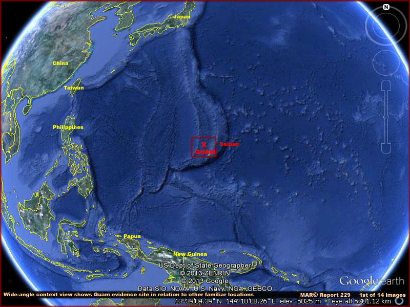
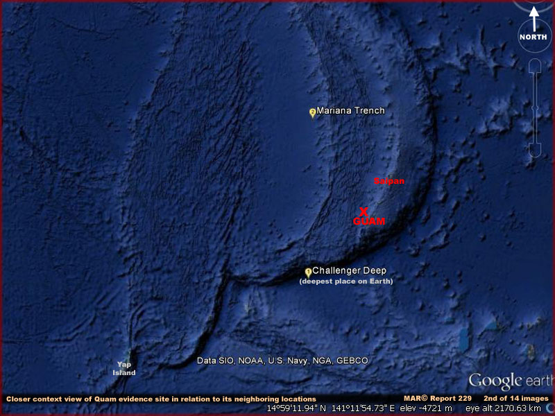
The red 'X' marks the evidence location on
the north and west side of Guam. The above 1st and 2nd images provide wide-angle
context views to make sure that all those viewing this report can find the
evidence in Google Earth to verify it for them selves as long as it remains
available there and how the evidence site generally looks and fits in with
its neighbors on a macro basis. I've also included Saipan labeling simply
because it is nearby, because it is the subject of my prior Report
224, and the mining evidence there is similar although with some important
differences.
While you are looking at the above wide angle views in this report and noting
the relatively normal very large bottom features of the area, take special
note that all this evidence sits on a very deep but raised land form shaped
similar to an ancient samurai warlord gloved
hand or fist. Note also that this undersea formation extends north to south
from the Japanese islands and into the south Pacific past Guam. As a possible
symbol this would likely have been known even in ancient times. One has to
wonder if this is a symbol and does it represent just coincidental geology
or intentional intelligent design?
Meanwhile, regardless of any similarities, the Guam evidence is unique and
significantly different in some ways than previously reported on undersea
evidence. Although also down on the bottom in the black dark abyssal deep
and subject to immense killing pressures, it is in water actually a little
more shallow in a few places than in the previously reported evidence and
of an apparently somewhat different type. Further, wave form graphic obfuscation
often seen in Google Earth material plays a bit more involved roll here and
obfuscation is fairly plentiful.
For example, when one attempts to zoom in closer the wave form obfuscation
graphics technique gets more and more intense but then upon even deeper zoom
beyond that point the obfuscation suddenly gives out in places allowing a
clearer view. The images below demonstrate some of this.
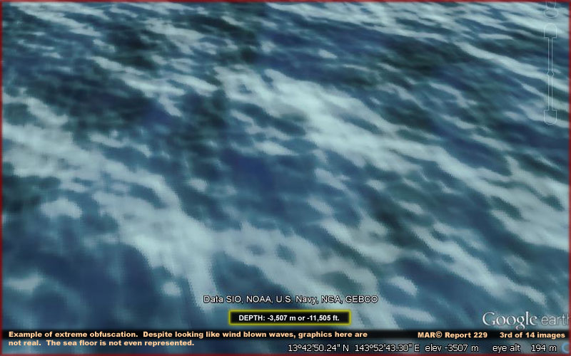
The above 3rd image is wave graphics off
of Guam in the general area completely obscuring any evidence on the bottom
of any kind. I include it just to demonstrate how thoroughly effective and
bad it can be in places and it cannot be defeated. It looks like wind blown
waves on the water's surface. I might add that this wave form graphic look
is a surface design sometimes employed in movies as graphics to represent
the "event horizon" of a dimensional gateway. The movie "Stargate"
is an example. However, note that the water depth here as bracketed in yellow
in the above 3rd image is -3,507 meters or 11,505 feet indicating what is
really going on even if we can't see anything but fake graphics.
The graphic is nothing more than illusion and obfuscation as used here in
this material. It should be noted that the sea floor Guam evidence reported
on here appears to cover an area of about 60 x- 60 km or 37 x 37 miles. So
yes it's a big area but that may be misleading. Why? Because that's just what
we are allowed to see and can detect in Google
Earth before obfuscation tacticals tend to obscure everything else from view.
The fact is that true evidence could be even greater. For example, I would
like to know what is at the end of that samurai's thumb that sticks out like
a pointing finger? Could that be an gigantic ancient marker?
The word "allowed" is intentionally
used by me. In my experience, those that do the usual obfuscation would not
want us to see this kind of evidence and would hide it if they could. The
fact that we are seeing this type of evidence at all suggests that someone
with greater power is making it available to us and keeping the normal secrecy
crowd backed up on hiding it. However, in my opinion, key features of the
evidence that would greatly help in our analysis of figuring out what is going
on with it are also being intentionally withheld. That suggests that would
be benefactors are also manipulating us. Don't loose sight of that possibility.
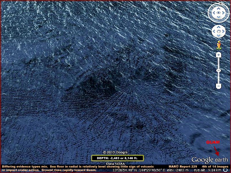
The above 4th image shows a more typical
scenario of the Guam bottom pattern evidence and what viewers may see in certain
areas as they attempt to verify this evidence in Google Earth to the north
and west of Guam. Note that the wave form obfuscation is less toward the bottom
of the above image but with the wave form obfuscation becoming more and more
of a problem factor moving up in the image.
An obvious thing that soon becomes apparent in the sea floor pattern evidence
is the fact that some of the evidence is geometric straight lineal. In other
words it comes in from off to the left in a relatively straight line or lines.
That straight linear approach compares favorably with evidence in my previous
reporting. However, note that there is also the radial pattern radiating out
from a central point crossing and overlapping the linear evidence. To achieve
this radial pattern, note that the each segment of the radial tapers from
a narrow point close to the center expanding wider and wider as it goes outward
to the perimeter edges. This is new and different than previously reported.
The radial evidence tends to suggest the possibility of an older volcanic
or impact crater radiating out from the center point. However, when tested
with the Google Earth depth meter, there is little evidence of depression
or raised ground supporting this. The bottom depth variations just aren't
sufficiently there in the form of raised or depressed areas in the sea floor.
The only thing that is clear is that there does appear to be up slope ground
moving southeast toward the lower right corner of the image and rising rapidly
via a deep sea escarpment to the island of Guam sticking out of the water
located just off image pointed out by red labeling.
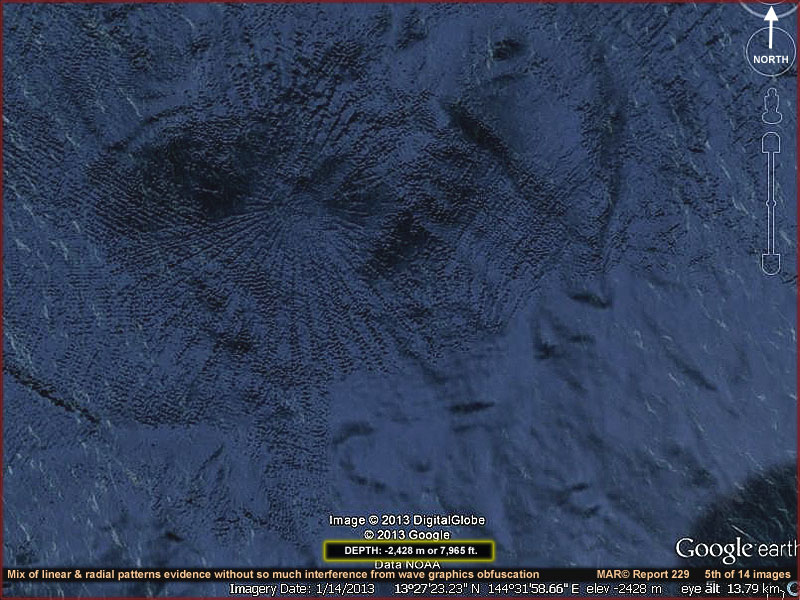
In the above 5th image the wave form obfuscation
is diminishing. The point here is that we are getting below the wave form
obfuscation layer as it is only on certain levels in this location. As we
near the point of getting below a level, the wave form obfuscation is beginning
to diminish. That means that anyone attempting to verify the evidence in Google
Earth should not give up. When you are examining this for yourself in Google
Earth keep on slowly zooming down until you just
clear the obfuscation layers and a clearer view of the sea floor evidence
will be the reward.
The problem is that getting under the obfuscation level also means getting
closer to the evidence and so the view tightens in at the periphery accordingly
tending toward a micro view rather than a wide macro view. This can be a good
thing in that it can provide a closer view of the evidence but it can also
be a not so good thing because it too often prevents a more distant wider
context view (without the obfuscation) showing how the various patterns fit
together. The wider context view is important on evidence like this that looks
strange as it inhibits trying to figure out what is going on with it overall.
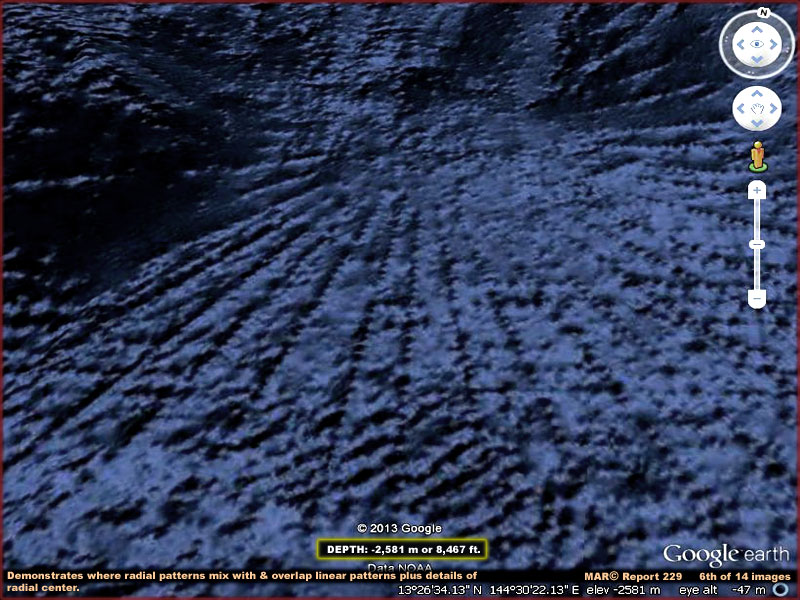
The above clearer 6th image is of the same
radial pattern as in the 4th and 5th images but now taken from a point below
the obfuscation layer and mostly free of it. It is mostly of the spot where
the straight lineal rectangular patterns intersect with and are overridden
by the radial pattern. Even though it is much clearer the evidence is just
too closely packed for it to definitively tell us very much about what exactly
is going on.
Even so note how very precise the radial patterns are. Note how each section
has a long taper. This much precision and geometry just does not occur in
natural geology. Also, in my opinion, ship survey sonar artifacts is just
too inadequate a theory to explain it. Only intelligent engineering design
and artificial equipment application can rise to a standard like this. Yet
the bottom here is 2,581 meters or 8,467 feet down and as dark as the inside
of a cave without lights. This tells us that either someone can see at these
extreme depths or they have equipment that can see for them.
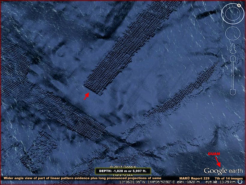
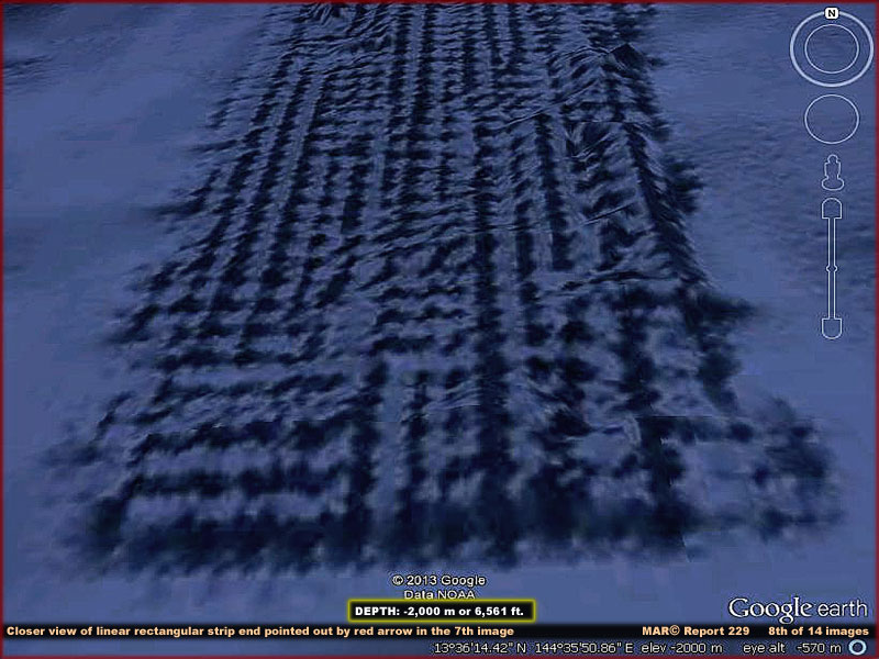
The above 7th and 8th images are merely representative
sample portions of the massive linear rectangular evidence here at this Guam
site. I've chosen locations on it to report on just because they offer clearer
views than other areas and because each has a somewhat different story to
tell rather than just repetition of a similar story as is the case with the
Saipan mining paths.
For example, the Saipan evidence in Report 224 tells the story of one or more
pieces of equipment traveling in search patterns at extreme depths with purpose
but likely involving only variations of a general equipment design producing
highly concentrated but very similar results on the sea floor surface. The
Saipan equipment evidence appears to suck up sediment from the bottom and
from inside cracks and crevasses exposing the underlying harder rock formations
and dispersed it to the side.
Here at the Guam site we have what might be sprawling evidence with differing
subtle characteristics located at slightly shallower depths. It might be mining
activity of a somewhat different design than the Saipan evidence where this
equipment drills deeper into the sea floor working in stages to get the last
little bit of what ever it is they are looking for depositing the discarded
fine grind tailings back the same place. Not all of the evidence fits this
scenario but much of it does.
Instead of vacuuming up sea floor sediment revealing the rough harder rocky
layer beneath it, this equipment appears to drill down to a deeper depth below
cutting through upper sediment and harder rock leaving the type of evidence
formations you see above which could essentially be a long series of many
taller pedestal formations left standing in these rigid geometric patterns.
Later, if warranted, another pass or two over the same spot grinding off the
pedestals and re-depositing the ground up tailings back in the same place
could produce something that then looks like smoother sediment except for
perimeter edges.
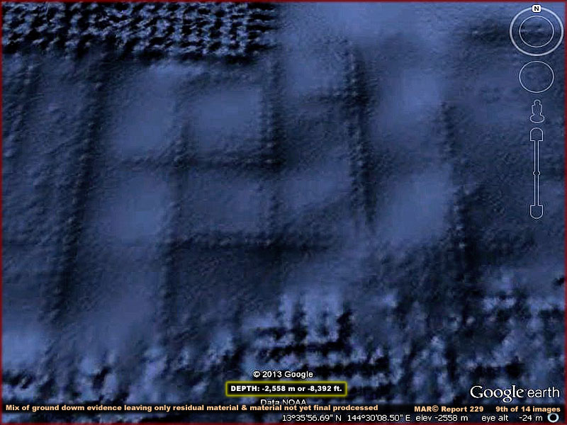
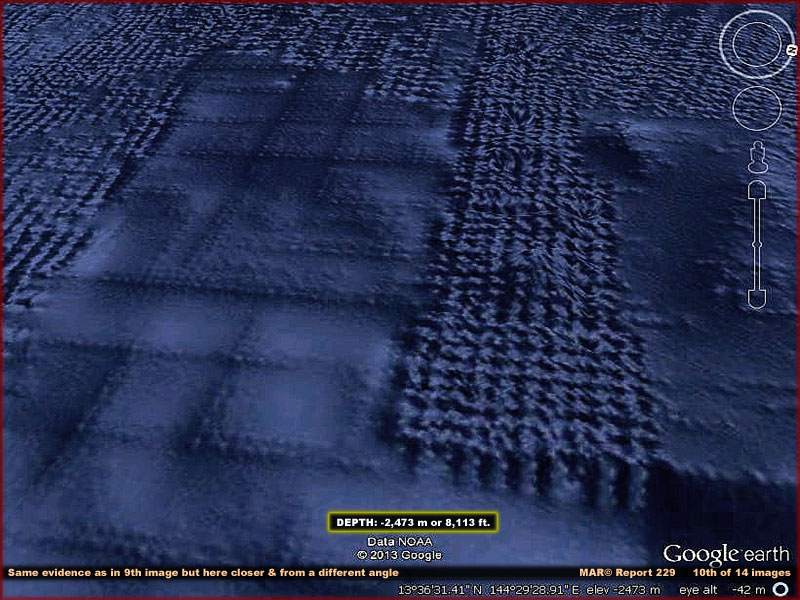
If this evidence is something real on the
sea floor, the above evidence in the 9th and 10th images demonstrates two
different looks of straight linear evidence that is going to be hard to explain.
Unavoidably at this point explanations will involve a lot of speculation.
First we have the rougher texture geometric evidence that I suspect represents
many tall objects (pedestals) ground out that fit into these very precise
grid formations on the sea floor. Almost certainly the tops and sides of each
of the many individual objects are cut into these very precise and pronounced
geometric forms by the mining machinery. Note that the smoother evidence areas
also seen here demonstrates likely having been in the same precise grid patterns
but have been subjected to another pass or two grinding down each tall pedestal.
Although ground mostly away, the outer perimeter can still be seen because
the grinding process likely deposited the finer grind tailings back into the
center area of each rectangle resulting in a deeper cover there and covering
over what is left there of the evidence.
In other words, I suspect the rougher looking evidence patterns represents
a first drilling of the sea floor leaving many upright pedestals of earth
and rock in a highly organized grid according to the size of the machinery
doing it while the smoother looking evidence represents the same thing but
mostly ground down and processed again producing finer sediments deposited
right back in place in the grind area. However, remember that what I am showing
you here are only representative samples of a much greater extensive whole
and such speculation could be premature.
What I'm saying though is that I still think we are looking at open surface
mining of the sea floor but here more intense than that which I have previously
reported on. Although in the end we're still talking about surface mining,
this kind of mining drills down deeper into the surface bedrock beneath the
ancient silt and sediment deposits trying to extract more of what ever it
is they are looking for.
Now it occurs to me that the mining concept could be a complete miss speculation
on my part. It occurs to me that the pedestal formations may be someone's
idea of home sweet home until they've served their usefulness. Someone's idea
fashioned by the influences of a distant past like that of bees (insects)
in a beehive living among honey comb cells or under ground. Something far
removed from known human origins? Someone perhaps from dark high pressure
worlds (or even this world) in dark space with dark adapted vision finding
more comfort in these Earth black dark ocean depths?
In fact, considering the rigid geometry of this evidence, it also occurs to
me that we may be looking at the activity of artificial machine life. Living
organic or hard substance (such as metal) life that can easily design parts
of itself to adapt to super dark high pressure liquid environments in order
to go after what it wants or needs in the form of raw materials. This concept
may seem far out to some of you at this stage in our development but in another
100 years or so we humans as organic life, if we survive, will almost certainly
reach the point in our scientific development where this is going to be one
of the possibilities of artificial life we're going to have to deal within
our own culture.
So, in and among this Guam evidence, I've looked for signs of activity indicating
someone treating this area as home sweet home and found no signs of it. No
traffic and no activity, just a lot of general mining like activity sameness.
Now that doesn't mean that it isn't there. If the grid evidence is real on
the sea floor, more and better evidence could be and almost certainly is selectively
hidden from our view. For example, I don't know but suspect some of the evidence
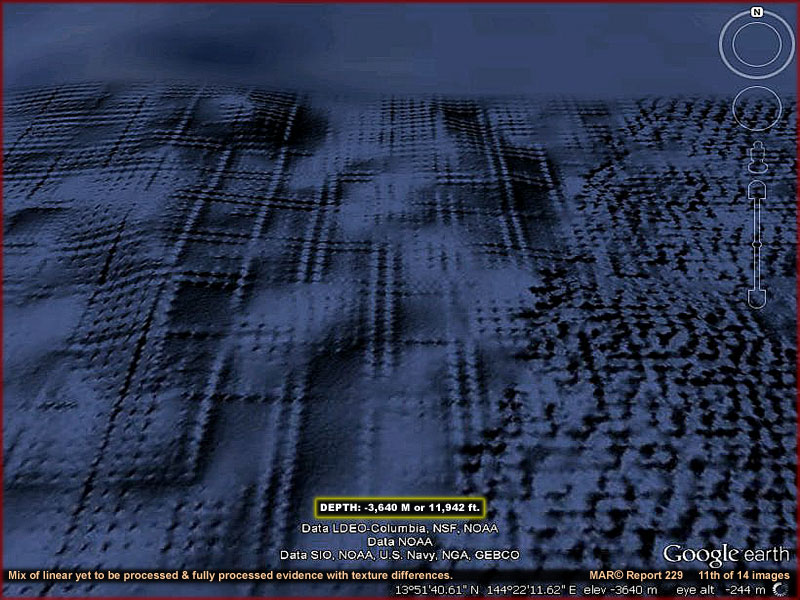
in the below 12th image that at first appears to be yet more linear grid evidence
may in fact be graphics designed to change and obscure something in that area.
This is one of the reasons why I thought this reporting right now may be just
too subjective and premature. I prefer of myself to have more confidence and
certainty in what I report on. While I do have considerable confidence in
this Guam evidence being mostly something real and artificially made on the
sea floor, I can't shake the feeling that we are still all being manipulated
by someone through the visual evidence and I suspect it's not the usual human
security crowd.
For example, in the below 12th image note the dense smudge in the very top
of the image and the sharp boundary it forms. In my opinion, this is image
tampering and I suspect it is allowed by someone that is not of our usual
security crowd. Why?
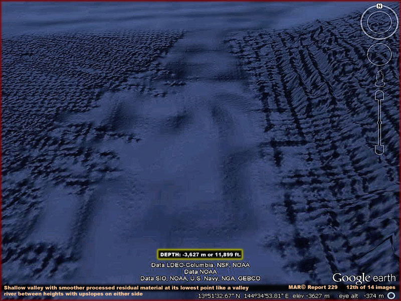
The scene in the above 12th image is a shallow
valley very nearby the 11th image scene. The linear grid sides slope upward
to the right and left. The smooth area in between represents a valley like
lower level and, although you can't see it here in this image, this lower
level has vague evidence in it of grids previously ground down. On the other
hand, the smooth area in the far background suggests that this is blur image
tampering covering something there and it is combined with more and more intense
wave form graphics that is definitely image tampering obfuscation.
If that mix isn't complex enough, the geometric patterns on the right in this
image suggests that this may be image tampering graphics and therefore may
not be real. In other words, there are a lot of different mixed signals here,
some legitimate and some not so much. That suggests intentional concealment
of something that might have informed us as to what is really going on here.
First we want you to see and recognize civilization evidence and understand
that it is present but as yet no further than that.
In my opinion the obfuscation has been generated by our usual secrecy crowd
but manipulated by someone else to give us a look at certain select evidence
that informs of civilization but does not allow an adequate perception of
who or what constitutes it. In other words, the obfuscation is allowed to
be there but then swept aside in certain places because it suites someone
else's purpose that is not our secrecy crowd and so here we go with the manipulation
again but by someone unknown.
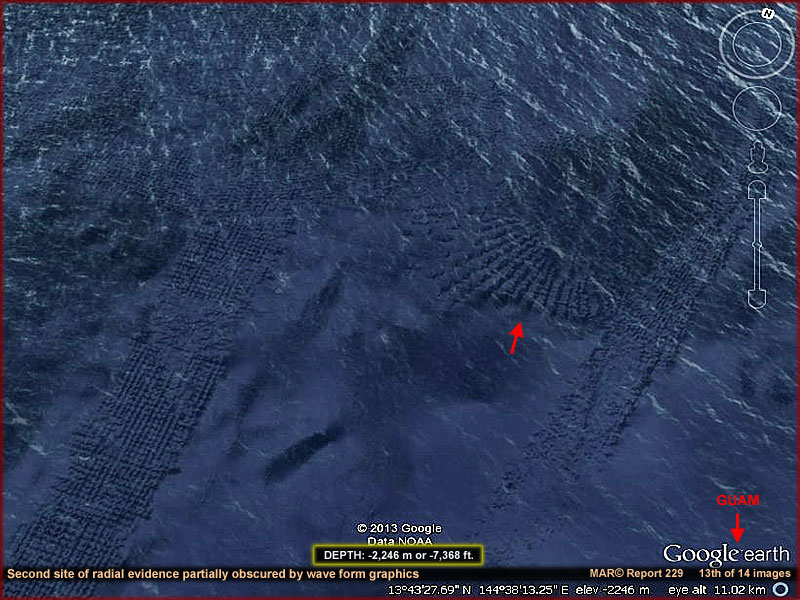
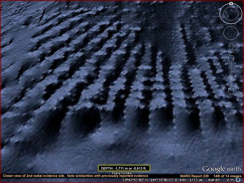
The above 13th and 14th images are of a second
smaller radial site at this Guam location. The 14th image provides a very
good closer view of the evidence. Note that each tall pedestal has lighter
color tips sticking out from the sides and tops. Note also that these objects
appear to repeat over and over again in the evidence like teeth on a saw blade.
Each is different but also all are the same. Further, upon careful inspection
and comparison with the 8th and 10th image evidence, the same appears to be
true of those images and their evidence as well.
This tends to support that this evidence is cut from the sea floor via very
large massive machinery to achieve this level of exactness and is not sonar
survey graphic artifacts as some want to postulate to placate mass populations.
That reinforces the concept that most of this evidence is something real on
the sea floor and, as such, represents intelligent design and on such a scale
that it leaves no doubt that we are looking at civilization evidence right
here on Earth that we do not fully understand.
But, that's just about all I can say about it with confidence. Who or what
it may represent remains a big unknown and the evidence that has been revealed
to us is geared only to allow that limited conclusion with any confidence.
The degree of evidence that has been revealed tends to support a long existence
here on Earth with a recent change toward us that allows us to have a look
while confirming that this someone is still here and functioning. Humans as
a group are ever myopic and often shy away from things that may lead to complexity
and the stress that goes with it and to which diminishment fantasy labels
can be attached.
Someone wants us to know that this evidence is here but at the same time their
cautious at dealing out information to us. Are we just being manipulated or
are we being tested as to whether we as a people can be open minded and adapt
to newly perceived realities YET? Or, are they
prepared to back away should we prove too fearful reactive and difficult to
deal with? If it's too much of the latter, maybe we'll wake up one morning
and find that all this evidence has been allowed to be removed from Google
Earth and it never existed. Yea, it was all just a bad dream.
Obviously there is a lot of speculation in all this and now perhaps you can
see why I thought it was premature to be getting into it at this time. The
mainstream would probably prefer that I keep quite or at most talk about sonar
artifacts but the cat is already out of the bag and I don't believe in the
sonar artifacts scenario and therefore just can't do it. If it looks like
civilization evidence, I'll report that likelihood until and if more future
evidence offers closer or more insight.
, Investigator
![]()