
MARS NORTH POLAR BIO-LIFE-1
Part-2
Report #123
August 1, 2007

The above sixth split screen image is from a different MGS MOC M1501266 narrow-angle strip. This strip too is more resolution compromised but still much can be identified in it. The left scene is the official science data view that has almost certainly been inverted at official level and the one on the right is the exact same scene inverted back by me to what clearly appears to be the correct more realistic view. Note the more isolated but wandering snake like smooth formation evidence in this scene.
Below this image point in the view at MSSS are a lot more of the smooth form evidence not shown here. There the ridges become so densely packed that they join forming densely packed right angle networks that do look much more like solid particulate dunes. The image location that you see above is the upper edge of the smooth form evidence and above this point there are no more of the smooth forms, only the bio-life forestation as you can see below.

The above seventh image is a scene immediately above and adjacent to the sixth image scene. As you can see, it gives two different views of the forestation growth evidence. The one on the left is the official view that has in my opinion been inverted at official level and the one on the right is the correct inverted by me view. This latter point is confirmed by the smooth form evidence. This evidence exist in a great plenty all around the North Polar Cap and other areas on Mars and normally appears like this and not as you see it in the left spit screen.
In either view, you are looking at carpeting forestation growth of some kind unique to Mars with little to no rock and soil geology visible at all. This type of evidence extends all the way to the upper end of the strip in the MSSS view. One of the points I also want to make here in showing you this is that there is very obviously nothing visible at all in this extensive wide area terrain in the vicinity of the smooth forms that might suggest any loose particulate soil geology that in turn might have contributed to the presence of the smooth forms as "dunes."
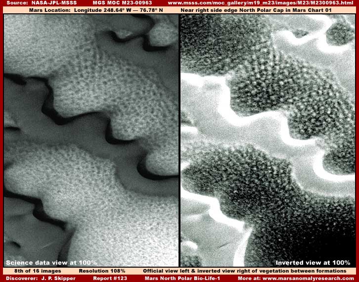
The above eighth image is yet again drawn from a different M23-00963 strip in the same general area just off in the terrain close to the North Polar Cap. I've thrown it into the mix here just to further demonstrate how the inverting process done at official level mixed with poorer resolution as demonstrated in the above left split screen view can so thoroughly alter the look of the forestation evidence into funky looking unrecognizability. The right split screen view is still compromised substantially by poor resolution over saturation but now the forestation is much more identifiable for what it really is.
Now we'll have to end Part-2 here and move to the next Part-3 in order to break up the slow loading time of these very large file size images that are counting all those many individual objects down there.
DOCUMENTATION FOR PART-2
http://www.msss.com/moc_gallery/m13_m18/images/M15/M1501266.html: This link takes you to the official MGS MOC M15-01266 narrow-angle science data strip that my above sixth and seventh images were drawn from.
http://www.msss.com/moc_gallery/m19_m23/images/M23/M2300963.html: This link takes you to the official MGS MOC M23-00963 narrow-angle science data strip that my above eighth image was drawn from.
![]()